GIS & Remote Sensing Lab

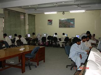
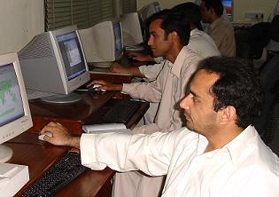
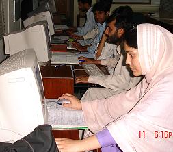
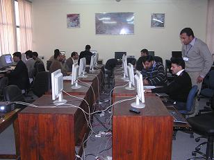
GIS/RS Laboratory is well equipped with good quality hardware, updated and well-versed software packages of GIS and RS. 

Post graduate Diploma in GIS/RS

National Centre of Excellence in Geology, University of Peshawar started 1-year Post graduate Diploma in GIS & Remote Sensing in 2002. Since then over 180 students have graduated under this Diploma programme. The diploma graduates have a variety of background including Civil Engineering, Geography, Environmental Sciences, Geology, Forestry, Computer Science, IT and many other fields. Diploma graduates have found employment in a variety of organizations in the country and abroad including UNDP, USAid, PTCL, GTZ, EPA, Programme Monitoring Unit (CM Secretariat), KIHE Afghanistan, Saudi Arabia Ministry of Transport, Pakistan Forest Institute, Forest Management Centre, Forest department, various public and private sector universities.

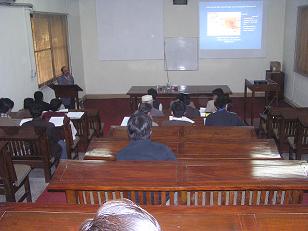
Following are few snaps-shopts and description of equipments available in Gis lab.


GIS Diploma Cources

Course# Title Credit Hr
Geol.655 Introduction to GIS
3
Geol.656 Introduction to Remote Sensing
3
Geol.657 Practical Exercise (ILWIS software)
2
Geol.666 Computer Mapping and data display
2
Geol.664 Case Studies in GIS/Remote Sensing
2
Geol.665 GIS and Remote Sensing Applications in Geosciences
2
Geol.655 Introduction to GIS
3
Geol.670 Practical exercise (Arc GIS software)
3
Geol.655 Introduction to GIS
3
Geol.661 Image Processing and Classification (ERDAS Imagine, ILWIS,)
2
Geol.672 Map-Info and its application
3
Geol.668 Digital Elevation Model (DEM)
2
Geol.659 Global Positioning System
2
------ Project Work
3


Geographic information system (GIS)

Applications of GIS technology are found useful in addressing virtually all our problems such as the management of natural resources, agricultural land use planning, water resources management, disaster management, environment planning and many more. The National Centre of Excellence in Geology, University of Peshawar, Pakistan, is offering One-year Post graduate Diploma program in GIS/RS since 2002, to create a critical mass of professionals. At the same time to raise awareness and usefullness of such technology in Pakistan, this centre is also organizing different short term training programmes from time to time with the collaboration of ICIMOD - Nepal, ITC - Netherland, ADPC - Thialand and GTZ Pakistan. GIS technology can be used for resource management, Geological mapping, muti-hazard risk assessment, pre and post-disaster planning, asset management, Environmental Impact Assessment, Urban planning, digital cartography, criminology, marketing, and route planning.


Remote Sensing

Remote sensing with its advantages of spatial, spectral and temporal availability of data covering large and inaccessible areas within short time has become a very handy tool in assessing and monitoring. Remote Sensing technology is applicable for: . Land use/land cover mapping and change detection . Agricultural assessment and monitoring . Coastal and marine resource management . Natural Resource Management . Minerals, oil & gas exploration . Forest resource management . Urban planning and change detection . Telecommunications siting and planning . Physical oceanography, Environmental Changes . Geology and topographic mapping . Sea ice detection and mapping, Glaciers movements . Floods forecasting, Drought conditions study


Short term trainings

Alonwith above mentioned courses, the Centre is also organizing national and international level short-term training programmes. Previously organized training programmes

1) Swat.

2) Regional Training Course on "Earthquake Vulnerability and Multi-Hazard Risk Assessment: Geo-Spatial Tools for Rehabilitation & Re-construction Efforts" 13-31 March 2006.

3) Training/Workshop on "Earthquake Vulnerability and Multi-Hazard Risk Assessment" 13-24 November 2006.

4) Training/Workshop on "Recent Developments in Geo-Hazards Disaster Management Focusing on Earthquake Vulnerability Reduction in Mountainous Regions " 11-23 August 2008.

5) Training Course on "Geo-Informatics for Disaster Management", 21-26 December, 2009