Multi-Hazard Risk Assessment:
Geospatial Mapping for Earthquake Vulnerability
March 13 - 31, 2006
| NCE in Geology | ICIMOD | ITC | ADPC |
| |
| Home |
| Introduction |
| List of Participants |
| Resource Persons |
| Organizers |
| Lecture Slides |
About ITC |
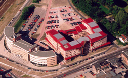
International Institute for Geo-Information and Earth Sciences, ITC – The Netherlands
 ITC primarily aims at international education,
flanked by research and project services. Its activities relate to international
knowledge exchange, focusing on capacity building and institutional development
in countries that are economically and technologically less advanced. ITC’s
activities concentrate on “Geo-information Science and Earth Observation”
whereby geo-spatial data collection is predominantly based on aerospace survey
techniques. Two distinct geo-spatial issues determine ITC’s focus: data
modelling (including information extraction from imagery) and production
processes. The Institute’s educational programmes, as well as its research and
project services, focus on two problem areas:
-
Solutions for the use of geo-spatial data, especially with respect to the management of space and resources.
-
Provision of geo-spatial data, which comprises issues such as concepts, technology, management and policy.
International Institute for Geo-Information Science and Earth
Observation (ITC)
an Associated Institute of the United Nations University
Hengelose Straat 99
P.O.Box 6, 7500 AA
Enschede
The Netherlands
Phone: 31 (0) 53 4874 489
Telefax 31 (0) 53 4874 336
http://www.itc.net.nl